Visto n' Visa
Blog
Notícias e artigos
Destinations
Careers
Immigrants

Want to live and work in Bakersfield?

Personalized immigration plan with eligible visas, costs, and next steps for your goal!

If you are not eligible, you will know exactly why and what to do to improve your approval chances.

Save up to 12 hours in meetings

No pointless assessments.

Save up to 90%

Save money on vague or unfocused consultations

Avoid Fraud and Mistakes

One mistake can cost you your visa

Total Impartiality

Zero commercial bias

Decide with peace of mind

No toxic urgency

Fast and Accurate

Answers in minutes, no guesswork

Bakersfield population: Hispanic majority, Okie community, and growing diversity

Approximately 53% Hispanic (Mexican), 33% white (many descended from Dust Bowl Okies), with African American, Filipino, and Sikh presence.

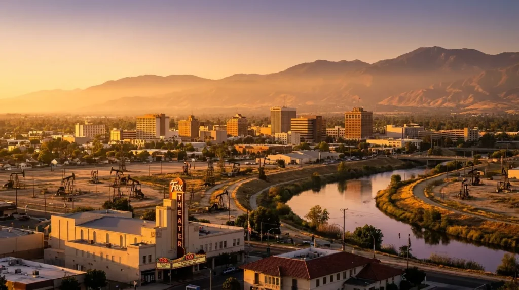
Bakersfield has a distinctive demographic profile within California. Approximately 53% of the population is Hispanic, with Mexican roots tied to agricultural and oil work for generations. About 33% is white, many of them descendants of the Okies (migrants from Oklahoma, Texas, and Arkansas who fled the Dust Bowl in the 1930s and popularized country music and evangelical Christianity).

About 6% is African American, 6% Asian (with a historic Filipino presence in Delano and a Sikh-Punjabi community in Bakersfield), and the remainder multiracial or of other backgrounds. The city has a strong Sikh community (part of the Central Valley's Punjabi diaspora), with gurdwaras (temples) and Indian restaurants particularly in East Bakersfield and Wasco. The undocumented community is sizable, tied to the harvest season.

The Brazilian community is very small, nearly invisible. Average income is below the California median, though the cost of living is also lower. The city leans conservative politically (in a liberal state), with a strong country music culture (the Bakersfield Sound, created by Buck Owens and Merle Haggard) and evangelical religious tradition. Large families and deep roots are part of the social fabric.

Languages spoken
  • English (strong country accent)
  • Spanish (Mexican, dominant)
  • Punjabi (Sikh community)
  • Tagalog (Filipino)
  • Vietnamese
  • +3 more
Main religions
  • Christian (strong evangelical, Latin Catholic)
  • Non-religious
  • Sikh
  • LDS (Mormon)
  • Buddhist
  • +1 more

Cost of living in Bakersfield: among the lowest in California

Rent and real estate cost half or a third of the coast. Even with high gas prices, a decent salary allows for savings.

Bakersfield has one of the lowest costs of living in California. A one-bedroom apartment in central neighborhoods (Downtown, Westchester) rents for between USD 1,000 and USD 1,400 per month. A three-bedroom house to rent runs USD 1,600 to USD 2,300. Purchasing a modest home costs between USD 280,000 and USD 450,000, far less than in LA or SF.

Grocery shopping at Vons, Albertsons, Food 4 Less, WinCo, and Vallarta (Mexican) is reasonably priced. A meal at a casual restaurant costs between USD 12 and USD 22. Mexican restaurants serve full combos for USD 9 to USD 14. Texas-style BBQ and Bakersfield-style barbecue (with chiles, wings, ribs, and frijoles) are local specialties. Indian food at Punjab Cafe and similar spots is also good and affordable.

Gas prices follow California's high standard (USD 4.50 to USD 5.50 per gallon). State income tax is progressive up to 13.3%, though the impact is lower for average earners. Private health insurance runs between USD 350 and USD 600 per month. A car is essential. Electricity bills in summer are high due to near-continuous air conditioning from June through September.

96Cost index (US = 100)4% below US average
CategorySingleCoupleFamily (2 + 2)
iHousing$1,249$1,441$1,825
iFood$365$730$1,325
iTransport$480$817$1,057
iHealthcare$269$538$1,009
iChildcare$1,748
iOther$817$1,470$2,066
Monthly total$3,180$4,996$9,030

Source: U.S. BLS Consumer Expenditure Survey 2023 + BEA Regional Price Parities 2023 · Estimates in USD, monthly.

Housing in Bakersfield: single-story homes across a sprawling suburb, more space for less

A horizontal city dominated by single-family homes. New neighborhoods in the southwest and northwest (Seven Oaks, Stockdale). Old Town has historic homes.

Bakersfield is an entirely horizontal city. Single-family stucco homes with yards and garages dominate nearly the entire city. Southwest neighborhoods (Seven Oaks, Stockdale, Riverlakes, Bakersfield Country Club) and northwest (Rosedale) are considered the best for families, with higher-rated schools, wide streets, and newer shopping centers.

Old Town Kern (near Downtown) has historic homes, some quite charming. Westchester features older, tree-lined neighborhoods. East Bakersfield is more working-class and diverse, with a strong Hispanic and Sikh community. South Bakersfield has more economically disadvantaged areas. Areas like Oildale (technically outside city limits) have strong Okie cultural roots but are more economically challenged.

To rent, landlords typically require a credit check, proof of income (2.5 to 3 times the rent), and references. Those arriving without a US credit history may need a co-signer or to pay additional months upfront. Popular platforms include Zillow, Apartments.com, Trulia, Craigslist, and Facebook Marketplace. In Bakersfield, finding a property is relatively straightforward: supply exceeds demand. Spacious apartments (1,000-1,200 sqft) with community pools are common.

Recommended neighborhoods
  • Seven Oaks (southwest, top schools, families)
  • Stockdale (planned community, golf course)
  • Riverlakes (artificial lakes, new homes)
  • Bakersfield Country Club (classic, golf)
  • Rosedale (northwest, newer development)
  • +3 more

Job market in Bakersfield: oil, agriculture, healthcare, and logistics

Chevron has a major operation here. Agriculture employs large numbers. Hospitals and logistics (Amazon, FedEx) also significant. Decent average salaries.

Oil is Bakersfield's defining sector. Kern County produces approximately 70% of California's oil, with Chevron (the city's largest employer), Aera Energy (a Shell/ExxonMobil joint venture), California Resources Corporation, and dozens of smaller companies. Jobs range from engineering (geologists, petroleum engineers) to field operations (pump jacks, maintenance). Engineering salaries range from USD 90,000 to USD 160,000. Field operators earn USD 60,000 to USD 90,000.

Agriculture employs large numbers of workers. Grapes (raisins, table), almonds, pistachios (Wonderful Pistachios in Lost Hills), carrots (Grimmway Farms and Bolthouse Farms are based here), citrus, and potatoes. Direct jobs in harvesting, packing houses, and irrigation. The logistics sector has grown: Amazon, FedEx, UPS, Walmart, and the trucking industry use Bakersfield as a strategic hub (at the intersection of Highway 99 and I-5).

Healthcare is the second-largest sector. Adventist Health, Bakersfield Memorial Hospital, Mercy Hospitals (Dignity Health), and Kern Medical (county hospital) employ tens of thousands. Education (Bakersfield City School District, Cal State Bakersfield) is also significant. The state minimum wage is USD 16 per hour (2024). Agricultural work pays close to minimum wage, generally on a piece-rate basis. Software engineers (rare in the city) earn USD 85,000 to USD 130,000.

Dominant sectors
  • Oil and gas
  • Agriculture and agribusiness
  • Healthcare
  • Logistics and distribution
  • Government (Kern County, City)
  • +3 more
Major employers
  • Chevron (operations in Kern County)
  • Aera Energy
  • California Resources Corporation
  • Kaiser Permanente
  • Adventist Health Bakersfield
  • +5 more

Education in Bakersfield: varied districts, Cal State Bakersfield is the university

Multiple school districts. Panama-Buena Vista and Norris generally have the highest ratings. CSUB is the local public university; Bakersfield College is the community college.

Bakersfield is served by several school districts. Bakersfield City School District (K-8), Kern High School District (9-12, one of the largest high school districts in California), Panama-Buena Vista Union, Norris, and Rosedale are the main ones. Panama-Buena Vista and Norris (serving the southwest and northwest) generally have the highest-rated schools. Families often choose their neighborhood based on school quality.

California State University, Bakersfield (CSUB), at the southwestern edge of the city, is the local public university, part of the Cal State system. It enrolls approximately 11,000 students and is strong in geology (due to the oil industry), education, business, engineering, and nursing. Bakersfield College (BC), a community college founded in 1913, is one of the oldest and most respected in California, with a strong transfer program to UCs and CSUs.

Other institutions include West Hills College Taft, Taft College, and several smaller private colleges. Tuition at CSUB for international students is approximately USD 17,000 per year. At Bakersfield College, approximately USD 7,000 per year. Many immigrants start at community college (BC) and transfer to CSUB or a UC. Ross University's osteopathic medicine program has a campus in Bakersfield.

Notable universities
  • California State University, Bakersfield (CSUB)
  • Bakersfield College (community college)
  • Taft College (community college, Taft)
  • West Hills College Taft
  • California Health Sciences University (in Clovis, nearby)
  • Ross University School of Veterinary Medicine (campus in Bakersfield)

Healthcare in Bakersfield: solid regional network, but specialist shortage

Adventist Health, Bakersfield Memorial, and Kern Medical lead the network. For certain specialized treatments, patients travel to LA or Fresno.

Bakersfield has a functional hospital network relative to its size. Adventist Health Bakersfield, Bakersfield Memorial Hospital (part of Dignity Health/CommonSpirit), and Mercy Hospital (also Dignity) are the largest. Kern Medical Center (county hospital) has a Level 2 Trauma Center and serves emergency cases and the uninsured population. Kaiser Permanente has opened a facility in the city.

The system runs on private health insurance, typically employer-sponsored. Chevron and major oil companies offer generous coverage plans. Agricultural workers are generally covered by federal programs (Medi-Cal, expanded in 2024 to undocumented adults in California). Without coverage, a basic walk-in clinic visit costs USD 100 to USD 200.

The main challenge is a shortage of specialists (oncologists, pediatric neurologists, specialized surgeons). For many complex treatments, Bakersfield patients travel to LA (Cedars-Sinai, UCLA) or Fresno (Community Regional). Community clinics such as Clinica Sierra Vista, Omni Family Health, and Adventist Health Clinics serve patients on a sliding scale, particularly in agricultural neighborhoods. For emergencies, all hospitals provide care regardless of ability to pay.

Healthcare index58.0 / 100
  • Life expectancyyears at birth
    78.4yrs
  • Doctors per 1kpracticing physicians
    3.7
  • Health spendper capita, per year
    $13,473
  • Public systemoverall quality rating
    Fair

Safety in Bakersfield: above-average crime, varies significantly by neighborhood

Property and violent crime are above the national average. The southwest is safe. East Bakersfield, Oildale, and the south have higher crime rates.

Bakersfield has crime rates above the national average. Theft, vehicle theft, assault, and drug-related crimes occur more frequently than in similar cities in other states. The situation varies considerably by neighborhood. The southwest (Seven Oaks, Stockdale, Riverlakes), northwest (Rosedale), and country club neighborhoods are safe, with low property crime.

East Bakersfield, South Bakersfield, and Oildale (an unincorporated area to the north) historically have higher crime, with gang activity and drug trafficking (particularly methamphetamine). A homelessness crisis exists, primarily near the Kern River bed, in Downtown, and along Highway 99. The police (Bakersfield PD) and Kern County Sheriff maintain a strong presence but face staffing constraints.

The most common crimes affecting immigrants include smash-and-grab car break-ins (leave nothing visible), vehicle theft (particularly Honda Civics, Toyota Camrys, and Ford pickups), residential burglary in areas without alarms, and catalytic converter theft. Extra caution is advised in shopping center parking lots at night and at isolated gas stations. In general, living in the southwest avoids most of these issues.

5.8
Homicides per 100k
per year
Safety index
38.0
Crime index
62.0
Safer neighborhoods
  • Seven Oaks
  • Stockdale
  • Rosedale
  • Polo Grounds
  • Northwest Bakersfield
  • Haggin Oaks
Areas to avoid
  • East Bakersfield in isolated stretches at night
  • Downtown areas late at night
  • Stretches near oil fields during off-peak hours
  • South Bakersfield in certain spots

Transportation in Bakersfield: car-dependent city, Amtrak to the Bay Area and LA

A car is completely essential. Golden Empire Transit operates basic bus service. Amtrak connects Bakersfield to LA by bus and to the Bay Area by train.

Bakersfield is an entirely car-dependent city. The main freeways (Highway 99, Highway 58, Interstate 5 to the west) run through the region. The city is so spread out that crossing from one end to the other takes 20 to 30 minutes. Parking is cheap and plentiful everywhere.

Golden Empire Transit (GET) operates buses across the city, with basic routes connecting neighborhoods to Downtown. The system works for those without other options, but coverage is limited and schedules are infrequent. Cycling is feasible in some flat areas, but summer heat significantly limits its use.

Meadows Field Airport (BFL) is small, with direct flights to Phoenix, Denver, Las Vegas, Dallas, and some regional cities (San Francisco via United Express). For international flights or most destinations, most travelers drive to LAX (2 hours), Burbank (2 hours), or Fresno (1 hour 45 minutes). The Amtrak San Joaquin connects Bakersfield to Hanford, Fresno, Modesto, and Sacramento/Bay Area by rail. There is no direct train to LA; passengers take a Thruway bus connection. California High-Speed Rail, currently under construction, is set to connect Bakersfield to San Francisco and Los Angeles in the future.

21 min
Avg commute
32
Walkability
Airports
  • BFL — Meadows Field Airport (regional, no regular international flights)
  • LAX — Los Angeles International Airport (accessible by car or bus)
  • Bike infrastructure

What the climate is like living in Bakersfield

Bakersfield has a hot semi-arid climate in the San Joaquin Valley, with long and very hot summers, mild winters, dense tule fog, and rainfall concentrated in the winter months.

Summer is long and intense, running from May through September. High temperatures typically fall between 95 and 104 degrees Fahrenheit, with peaks above 108 in July and August. Low humidity provides some relief, but air quality is a persistent concern due to the valley's geography. Reliable air conditioning is essential.

Winter is short and mild, from December through February, with highs between 57 and 63 degrees Fahrenheit and lows between 37 and 43. The defining seasonal phenomenon is tule fog, a dense ground fog that can reduce visibility to near zero on cold mornings and regularly disrupts traffic. Heating needs are limited.

Annual rainfall averages around 6.3 inches, concentrated in winter. Air quality is frequently poor, particularly in summer. For residents, dependable air conditioning, attention to air quality alerts, and cautious driving during foggy mornings are practical priorities.

Sunny days / year271 days
Avg high (°F)
  • 62°J
  • 66°F
  • 70°M
  • 82°A
  • 89°M
  • 98°J
  • 105°J
  • 104°A
  • 97°S
  • 85°O
  • 70°N
  • 62°D
Avg low (°F)
  • 42°J
  • 42°F
  • 47°M
  • 55°A
  • 62°M
  • 70°J
  • 76°J
  • 76°A
  • 69°S
  • 58°O
  • 46°N
  • 42°D
Rainfall (")
  • 2"J
  • 1"F
  • 2"M
  • 1"A
  • 1"M
  • 0"J
  • 0"J
  • 0"A
  • 0"S
  • 0"O
  • 1"N
  • 3"D

Culture in Bakersfield: country music, BBQ, basketball, and agricultural tradition

A conservative city with a strong country music culture (Bakersfield Sound), Mexican food and BBQ, high school football, and agricultural festivals.

Bakersfield has a distinctive culture within California. The Bakersfield Sound, a style of country music developed in the 1950s and 1960s by Buck Owens and Merle Haggard, still defines the local musical identity. The Crystal Palace, a venue founded by Buck Owens, continues to operate with live performances. Festivals include the Bakersfield Country Music Festival and the Pizza Festival.

The food scene blends Mexican cuisine (Mexicali, Casa Munoz, Luigi's), BBQ (Wool Growers Restaurant, a historic Basque establishment), Basque food (Bakersfield has a historic Basque community descended from sheep herders, featuring dishes like lamb, soups, and red wine served family-style at long tables), Indian food at Punjab Cafe, and Caribbean/Cuban fare at Mama Roomba.

The Bakersfield Condors (AHL hockey) and the Bakersfield Train Robbers (minor league baseball) are the local teams. High school football is a local religion, with intense rivalries (Bakersfield High vs. Garces, BC vs. East). The city has a strong evangelical tradition, with megachurches such as The Bridge and Lighthouse. Agricultural fairs like the Kern County Fair (in September) and rodeos draw thousands of attendees.

Bakersfield

Attractions and culture in Bakersfield, California

A Central Valley city and capital of the Bakersfield Sound, with a historic country music scene, oil and agriculture museums, and easy access to the Tehachapi Mountains and Sequoia.

Bakersfield holds a distinctive place in American music history as the birthplace of the Bakersfield Sound, a country style that rose to prominence through Buck Owens and Merle Haggard. The Crystal Palace, a music venue once owned by Buck Owens, and the Buck Owens' Crystal Palace Museum keep that legacy alive. The Bakersfield Music Hall of Fame celebrates the broader scene.

The Kern County Museum spans 56 buildings across an open-air campus, documenting the valley's agricultural and oil history. The California Living Museum (CALM) operates as a combined zoo and botanical garden focused on California's native wildlife and plants, while the Buena Vista Museum of Natural History displays fossils recovered from the surrounding region. Downtown features the restored Fox Theater and the Padre Hotel, a long-standing local landmark.

Nature is close at hand: Sequoia National Forest lies to the east, home to giant sequoias and Lake Isabella; the Tehachapi Mountains are known for the historic Tehachapi Loop railroad feature; Hart Park and the Kern River Parkway along the river offer roughly 30 miles of urban trail, fishing areas, and camping. Highway 99 and I-5 connect the city to Los Angeles in about two hours.

  1. 1["Kern County Museum"
  2. 2"Buck Owens' Crystal Palace"
  3. 3"California Living Museum (CALM)"
  4. 4"Bakersfield Museum of Art"
  5. 5"Fox Theater"
  6. 6"Mesa Marin Sports Complex"
Nightlife4.0 / 10
Parks & green spaces
  • ["Hart Park"
  • "Yokuts Park"
  • "Mill Creek Linear Park"
  • "Beach Park"
  • "Kern River Parkway"
  • +1 more

Latest posts

Posts about California

Coverage and updates related to this destination.

Showing content from California, as there is no specific data for Bakersfield yet.