Visto n' Visa
Blog
Notícias e artigos
Destinations
Careers
Immigrants

Want to live and work in Richmond?

Personalized immigration plan with eligible visas, costs, and next steps for your goal!

If you are not eligible, you will know exactly why and what to do to improve your approval chances.

Save up to 12 hours in meetings

No pointless assessments.

Save up to 90%

Save money on vague or unfocused consultations

Avoid Fraud and Mistakes

One mistake can cost you your visa

Total Impartiality

Zero commercial bias

Decide with peace of mind

No toxic urgency

Fast and Accurate

Answers in minutes, no guesswork

A majority Latino and Black city with a strong Asian presence

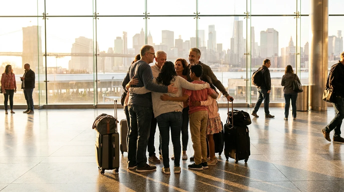
Richmond is one of California's most diverse cities: approximately 44% Latino, 18% Black, 14% Asian, and 17% non-Hispanic white, with well-defined neighborhoods shaped by origin and generations of immigration.

Richmond has one of the most balanced compositions in the Bay Area across major groups. The Latino population is predominantly Mexican, concentrated in Iron Triangle, Coronado, and North Richmond, with a growing presence of Central Americans. The Black community grew historically during World War II, when Kaiser shipyards drew workers from the American South.

The Asian community comes primarily from the Philippines, Laos (Lao and Mien), China, and India. The Laotian and Iu Mien diaspora is particularly notable: Richmond is home to one of the largest Mien communities in the country, refugees who arrived after the Vietnam War. There is also a significant presence of Samoans and Tongans in Marina Bay and Hilltop.

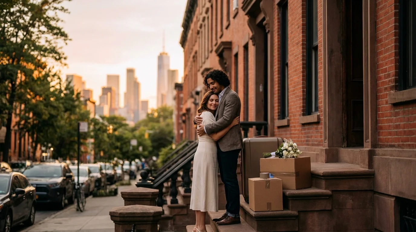
Median household income is around $75,000, below the Bay Area average, and approximately 16% of the population lives in poverty. The median age is 37, with a strong presence of families with children in residential zones and young professionals in the condominiums of Marina Bay and Point Richmond.

115,731
Population
37 yrs
Median age
$84,000
Median income
per year
Urban population95.0%
Foreign-born33.0%
Languages spoken
  • English
  • Spanish
  • Tagalog
  • Mandarin
  • Iu Mien
  • +2 more
Main religions
  • Catholic
  • Protestant (Black Baptist and Pentecostal churches)
  • Buddhist
  • Sikh
  • Hindu
  • +1 more

More affordable than San Francisco and Berkeley, but far from cheap

Richmond is one of the more accessible options in the Bay Area, with rents 30 to 40 percent below San Francisco, though still expensive by American standards. Groceries, transportation, and services follow the regional price level.

A one-bedroom apartment in Richmond rents for roughly $1,800 to $2,400 per month depending on the neighborhood, compared to $2,800 to $3,500 for the same unit in San Francisco or Berkeley. Marina Bay and Point Richmond sit at the top of the range, with newer waterfront condominiums. Iron Triangle and Richmond Annex have the most accessible rents, though supply is more limited.

For buyers, single-family homes in residential neighborhoods such as Richmond View and El Sobrante range from $700,000 to $900,000. In Point Richmond, bay-view homes easily exceed $1.2 million. Water, sewer, and electricity rates follow PG&E standards, which are known to be expensive: monthly bills of $200 to $350 are common in winter.

Groceries tend to run cheaper at chains like Foods Co, FoodMaxx, and the Mexican markets on 23rd Street, with Safeway and Lucky covering standard options. Dining out in Point Richmond or Hilltop runs $18 to $35 per meal. The ferry to San Francisco costs $9.50 each way, and BART to downtown San Francisco is $6.90.

128Cost index (US = 100)28% above US average
CategorySingleCoupleFamily (2 + 2)
iHousing$2,350$2,850$3,600
iFood$540$940$1,480
iTransport$360$580$800
iHealthcare$260$460$760
iChildcare$2,800
iOther$390$720$1,110
Monthly total$3,900$5,550$10,550

From workers' cottages to waterfront condominiums

The housing stock ranges from historic bungalows dating to the Kaiser shipyard era in Point Richmond to newer buildings in Marina Bay. The market is less competitive than Berkeley or Oakland, but has heated up as professionals leave San Francisco.

Point Richmond is the most sought-after neighborhood, featuring Victorian and Craftsman homes from the 1900s, tree-lined streets, and a small-town feel with walkable bars, restaurants, and bakeries. Marina Bay has the newest stock: condominiums and townhouses from the 1990s and 2000s with a private marina, a bike path to the ferry, and views of the Bay Bridge. It is popular among tech professionals who commute by ferry.

El Cerrito Hills (at the border) and Richmond View are middle-class neighborhoods with 1950s single-family homes on curving streets with bay views. Hilltop has newer homes from the 1970s and 1980s on larger lots. Iron Triangle, North Richmond, and Coronado have the lowest prices, but require careful research into specific blocks.

Rentals typically require proof of income at 2.5 to 3 times the rent, a credit score above 650, and two recent pay stubs. Older homes may have lead paint or galvanized iron plumbing, making an inspection worthwhile. Central heating is common; air conditioning is rare given the mild climate.

Purchase price (m²)
  • Center$8,000/m²
  • Outside$6,500/m²
9.5×
Price-to-income
6.9%
Mortgage rate (20y)
Recommended neighborhoods
  • Point Richmond
  • Marina Bay
  • Richmond View
  • El Cerrito Hills
  • Richmond Annex
  • +1 more

Refinery, port, healthcare, and federal laboratories

Chevron is the largest private employer, with the refinery directly and indirectly employing thousands. Healthcare through Kaiser Permanente, the port, and Lawrence Berkeley National Laboratory round out the landscape.

The Chevron refinery in Richmond has operated since 1902 and is one of the largest on the West Coast, with a heavily unionized workforce and wages well above the city average. The Port of Richmond employs workers in port operations, logistics, and shipyards. Kaiser Permanente, which was born in Richmond during the shipyard era, maintains a large hospital and medical centers throughout the area.

The Richmond Field Station, affiliated with UC Berkeley, and part of Lawrence Berkeley National Laboratory attract researchers and technicians in applied sciences. The city also hosts Marin Clean Energy and several biotech and cleantech companies in Marina Bay. The construction trades and unionized building crafts have a strong presence, with active locals for electricians, carpenters, and plumbers.

For those commuting out, the typical route is BART to downtown San Francisco, downtown Oakland, or Berkeley, or the ferry to the Financial District in San Francisco. AC Transit runs transbay lines directly to San Francisco. Healthcare workers find additional opportunities at Sutter Health, John Muir Health, and UCSF-affiliated facilities in Berkeley and San Francisco.

$5,300
Avg net salary
per month
$2,800
Minimum wage
per month
4.0%
Unemployment
62.5%
Labor force
Dominant sectors
  • Refining and petrochemicals
  • Healthcare and biotechnology
  • Port logistics
  • Federal scientific research
  • Unionized construction trades
  • +1 more
Major employers
  • Chevron Richmond Refinery
  • Kaiser Permanente
  • Port of Richmond
  • Lawrence Berkeley National Laboratory (Richmond Field Station)
  • Contra Costa County
  • +2 more

A recovering school district and proximity to UC Berkeley

West Contra Costa Unified serves the city with public schools of varying quality. For higher education, Contra Costa College is the local entry point; UC Berkeley is 20 minutes away and draws many students from the region.

The West Contra Costa Unified School District (WCCUSD) operates the city's public schools. Quality varies considerably by neighborhood: schools in Point Richmond, Hilltop, and El Cerrito Hills tend to have higher ratings, while schools in Iron Triangle and North Richmond have historically received more federal and state resources to close achievement gaps. Dual immersion programs (English-Spanish) are offered at several campuses.

Charter schools such as Making Waves Academy and Leadership Public Schools Richmond attract families seeking alternatives. For private education, St. David Catholic School and Salesian College Preparatory High School in Richmond are traditional options. Salesian is particularly known for its athletic program and strong college placement record.

Contra Costa College, in the San Pablo neighborhood, is the regional community college and offers two-year transferable credits to the UC and CSU systems. For four-year universities, UC Berkeley is 20 minutes by BART, while San Francisco State, Cal State East Bay, and USF are all within an hour. Stanford is about 90 minutes by car.

Literacy99.0%
Tertiary education50.0%
478
PISA score (avg)
$21,000
Private school
per year
Notable universities
  • Contra Costa College
  • UC Berkeley (20 min)
  • Cal State East Bay (40 min)
  • Lawrence Berkeley National Laboratory — Richmond Field Station

Kaiser was founded here and continues to dominate care

Kaiser Permanente, founded in Richmond during World War II to serve shipyard workers, maintains the city's main hospital. Sutter Health and community clinics round out the network.

The Kaiser Permanente Richmond Medical Center on Cutting Boulevard is the city's main hospital, covering emergency, surgery, maternity, and specialty care. Kaiser was literally founded in Richmond by Dr. Sidney Garfield to serve the 90,000 workers at Kaiser shipyards during the war, and the integrated health model was born from that experience.

Those without Kaiser coverage can use Contra Costa Regional Medical Center in Martinez (15 minutes) or hospitals in the Sutter Health and John Muir Health networks in the region. LifeLong Brookside Community Health Center serves low-income residents on a sliding scale and accepts Medi-Cal, with locations in Richmond and San Pablo.

For serious emergencies, ambulances typically transport to Kaiser Richmond, Highland Hospital in Oakland (Level 1 trauma center), or Alta Bates in Berkeley. Mental health is covered by Contra Costa Behavioral Health Services. 24-hour pharmacies are available in Hilltop and on Macdonald Avenue. Employer-sponsored insurance is the dominant coverage model; Medi-Cal and Covered California cover the rest.

Healthcare index65.0 / 100
  • Life expectancyyears at birth
    78.0yrs
  • Doctors per 1kpracticing physicians
    2.7
  • Health spendper capita, per year
    $12,000
  • Public systemoverall quality rating
    Good

A city in transition: statistics have improved considerably, but neighborhood awareness still matters

Richmond carried a reputation for decades as one of California's most dangerous cities, but violent crime dropped sharply after 2010 thanks to the Office of Neighborhood Safety program. Risk levels still vary significantly by neighborhood.

Homicides in Richmond fell from 47 in 2007 to fewer than 15 per year in the following decade, a transformation attributed to the Office of Neighborhood Safety (ONS), a pioneering program that combines conflict mediation with scholarships for at-risk youth. The city now has a violent crime rate below Oakland, though still above the Bay Area average.

Tourist areas such as Marina Bay, Point Richmond, and the ferry terminal are quite calm at any hour. Hilltop, Richmond View, and El Cerrito Hills have a suburban profile with low crime. Iron Triangle (between BART and Macdonald), Coronado, North Richmond, and parts of 23rd Street to the south require more caution, especially at night, with car break-ins being the most common complaint.

Vehicle break-ins are unfortunately a Bay Area-wide problem, and Richmond is no exception. Nothing visible should be left in a car, even in Marina Bay. The Richmond Police Department is reasonably responsive, and the Neighborhood Watch program is active in Point Richmond and Marina Bay. Street lighting has been improved in recent years.

6.0
Homicides per 100k
per year
Safety index
38.0
Crime index
62.0
Safer neighborhoods
  • Point Richmond
  • Marina Bay
  • Richmond View
  • El Cerrito Hills
  • Hilltop
  • Richmond Annex
Areas to avoid
  • Iron Triangle (at night)
  • North Richmond (at night)
  • Coronado (after dark)
  • Isolated sections of the Richmond Greenway after dark

BART, ferry, and AC Transit connect to the entire bay

Richmond is the northern terminus of BART's orange and red lines, has direct ferry service to San Francisco, and is crossed by Interstates 80 and 580. Getting out of the city is easy; getting around within it benefits from a car.

Richmond BART Station is centrally located and connects directly to Berkeley, Oakland, downtown San Francisco, and SFO Airport (with a transfer). It is one of the busiest terminals outside San Francisco. The Richmond Ferry Terminal in Marina Bay offers regular crossings to the Ferry Building in San Francisco, with a travel time of 35 minutes. Service is operated by San Francisco Bay Ferry.

AC Transit serves the city with several local lines and operates transbay routes (lines L and LA) directly to the Transbay Terminal in San Francisco. I-580 leads to the Richmond-San Rafael Bridge and Marin County in about 15 minutes. I-80 heads toward Berkeley and San Francisco to the east, and to Vacaville and Sacramento to the north. Traffic is heavy during peak hours, especially on the Carquinez Bridge.

Bike infrastructure is expanding: the Bay Trail runs along the Richmond waterfront with continuous paved segments from Marina Bay to Point Pinole. The city has bike lanes on several major avenues, and the Richmond Greenway, a converted former rail corridor, crosses the city east to west. A car is useful for groceries and travel outside BART hours, though parking is generally manageable outside of Point Richmond and Marina Bay.

2
Metro lines
3
Metro stations
34 min
Avg commute
52
Walkability
Airports
  • OAK — Oakland International (40 min)
  • SFO — San Francisco International (50 min)
  • Bike infrastructure

Living with the climate in Richmond

San Francisco Bay Mediterranean: dry, mild summers and mild, rainy winters. Ocean and bay breezes keep everything temperate.

Summer in Richmond runs from June through October with highs between 22 and 26 degrees, dry air and cool nights near 13 degrees. The breeze coming through the bay keeps the heat gentle and in many homes air conditioning is unnecessary on almost every day of the year.

Winter is mild and rainy. Lows usually stay between 6 and 9 degrees and highs between 14 and 17 degrees. Heating is used for a few weeks and frost is rare. Snow does not fall in the city, only in distant mountains.

Rain concentrates between November and March, totaling 600 to 650 mm per year. Summer mornings often begin with heavy fog rolling in from the bay, which clears by noon. For daily life this means a light jacket nearly all year, a coat in winter, an umbrella and rarely feeling genuine heat.

Sunny days / year260 days
Avg high (°F)
  • 57°J
  • 60°F
  • 60°M
  • 66°A
  • 70°M
  • 74°J
  • 73°J
  • 76°A
  • 77°S
  • 73°O
  • 63°N
  • 56°D
Avg low (°F)
  • 45°J
  • 44°F
  • 46°M
  • 49°A
  • 52°M
  • 55°J
  • 56°J
  • 58°A
  • 58°S
  • 55°O
  • 48°N
  • 46°D
Rainfall (")
  • 5"J
  • 3"F
  • 4"M
  • 1"A
  • 1"M
  • 0"J
  • 0"J
  • 0"A
  • 0"S
  • 2"O
  • 1"N
  • 6"D

Shipyard memory, Latino murals, and multicultural festivals

Richmond celebrates its Home Front shipyard past at the Rosie the Riveter National Park, has a vibrant arts scene in Point Richmond, Latino and Asian festivals, and a network of murals that tell the city's history.

The Rosie the Riveter / WWII Home Front National Historical Park, in Marina Bay, tells the story of the women workers who built Liberty Ships during the war. It is administered by the National Park Service and has a free visitor center. The SS Red Oak Victory, one of the last surviving Liberty ships still afloat, is anchored at the Port of Richmond.

Point Richmond has a concentrated cultural scene, with the Masquers Playhouse (a community theater since 1955), art galleries, and the Hidden City Cafe. The Richmond Art Center, founded in 1936, is one of the oldest in the Bay Area and offers classes and exhibitions. Murals cover the city, especially along 23rd Street and Macdonald Avenue, depicting labor history, Latino heritage, and local Black leaders.

The dining scene reflects the diversity: 23rd Street and San Pablo Avenue are home to authentic Mexican taquerias, Salvadoran pupuserias, Filipino restaurants, and the well-regarded Salute e Vita Ristorante in Marina Bay, serving Italian pasta with water views. Cinco de Mayo and Juneteenth are major celebrations, and Iron Triangle Pride is an annual event.

4
Major museums
Notable dishes
  • Tacos al pastor (23rd Street)
  • Salvadoran pupusas
  • Filipino lumpia and adobo
  • Cantonese chow fun
  • Laotian larb and green papaya salad
  • +1 more
Annual events
  • Cinco de Mayo Festival
  • Juneteenth Celebration
  • Point Richmond Music on the Plaza
  • Richmond Home Front Festival
  • Festival of Globes (Lunar New Year)
  • +1 more

Bayfront parks, shipyard history, and a ferry ride with a view

Richmond's waterfront is the main draw: trails, marinas, the historic Rosie the Riveter Park, and Point Pinole Regional Shoreline. Point Richmond and Marina Bay offer walks with views of the Bay Bridge and Mount Tamalpais.

Point Pinole Regional Shoreline is the city's most spectacular park: 2,300 acres with trails, fishing, eucalyptus groves, and a long pier extending into the bay. The Bay Trail runs the entire waterfront with paved segments ideal for walking or cycling. Miller Knox Regional Shoreline in Point Richmond has a freshwater lagoon beach, picnic lawns, and sweeping views of the Golden Gate Bridge.

The Rosie the Riveter National Historical Park tells one of the most important home front stories of World War II. The SS Red Oak Victory, docked at the port, is open for tours. The Richmond Museum of History holds artifacts from the shipyard era. For a Sunday outing, the round-trip ferry to San Francisco becomes an attraction in itself, with the crossing passing under the Bay Bridge.

Brickyard Cove has a recreational harbor with sailboats at anchor and waterfront restaurants. Keller Beach at Miller Knox is one of the few East Bay beaches where swimming in the bay is feasible. Wildcat Canyon Regional Park climbs into the hills to the east, linking trails with Berkeley and Tilden. Hilltop Mall, formerly in decline, is being redeveloped as mixed-use.

  1. 1Rosie the Riveter / WWII Home Front National Historical Park
  2. 2Point Pinole Regional Shoreline
  3. 3Miller Knox Regional Shoreline
  4. 4SS Red Oak Victory
  5. 5Point Richmond Historic District
  6. 6Richmond Marina Bay
Nightlife4.0 / 10
Parks & green spaces
  • Point Pinole Regional Shoreline
  • Miller Knox Regional Shoreline
  • Wildcat Canyon Regional Park
  • Nicholl Park
  • Marina Bay Park
  • +1 more

A mosaic city of Latino, Southeast Asian, and Pacific Islander immigrants

About 28 percent of Richmond residents were born outside the United States. The largest communities come from Mexico, the Philippines, Laos, China, India, El Salvador, Guatemala, Vietnam, and the Pacific Islands.

Mexican immigration is the largest in volume, spread across central neighborhoods and along 23rd Street, which serves as the main Latino commercial artery with taquerias, panaderias, quinceañera shops, and grocery stores. Salvadorans, Guatemalans, and Hondurans also have a significant presence, with pupuserias and Central American markets alongside Mexican businesses.

Richmond is home to one of the largest Iu Mien and Laotian communities in North America, refugees who arrived after the Vietnam War with federal resettlement support. Wat Lao Nakhonpathom temple is an active community center. Filipinos are present in Marina Bay, Hilltop, and North Richmond, with a strong concentration in healthcare (Kaiser) and education. Chinese, Indian, and Vietnamese residents are distributed across Hilltop and newer neighborhoods.

The Samoan and Tongan community is one of the most visible outside Hawaii, with active churches and rugby teams. Eritrean and Ethiopian families are present along San Pablo Avenue. For services, organizations such as Catholic Charities of the East Bay, the RYSE Center, and Lao Family Community Development operate in multiple languages and assist with paperwork, schooling, and housing.

32,400
Foreign-born residents
estimated
Top countries of origin
  • Mexico
  • Philippines
  • Laos
  • China
  • India
  • El Salvador
  • Guatemala
  • Vietnam
Foreign consulates
  • Consulate General of Mexico in San Francisco
  • Consulate General of the Philippines in San Francisco
  • Consulate General of China in San Francisco
  • Consulate General of India in San Francisco
  • Consulate General of El Salvador in San Francisco
  • +2 more
Community organizations
  • Catholic Charities of the East Bay
  • RYSE Center
  • Lao Family Community Development
  • Bay Area Rescue Mission
  • Building Blocks for Kids Richmond
  • Asian Pacific Environmental Network (APEN) Richmond

Latest posts

Posts about California

Coverage and updates related to this destination.

Showing content from California, as there is no specific data for Richmond yet.